Items Similar to Antique Engraving of a Number of City Gates in England, c.1800

Want more images or videos?
Request additional images or videos from the seller
1 of 6
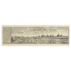
Antique Engraving of a Number of City Gates in England, c.1800
About the Item
Antique print titled 'Views of the City Gates (..)'. Old print with views of the city gates as they appeared before they were pulled down, together with the Old Gate at Whitehall & Templebar.
Artists and Engravers: Published by A. Hogg.
Condition: Good. General age-related toning, some defects. Please study image carefully.
Date: c.1800
Overall size: 38.2 x 24.7 cm.
Image size: 36.3 x 22.1 cm.
We sell original antique maps to collectors, historians, educators and interior decorators all over the world. Our collection includes a wide range of authentic antique maps from the 16th to the 20th centuries. Buying and collecting antique maps is a tradition that goes back hundreds of years. Antique maps have proved a richly rewarding investment over the past decade, thanks to a growing appreciation of their unique historical appeal. Today the decorative qualities of antique maps are widely recognized by interior designers who appreciate their beauty and design flexibility. Depending on the individual map, presentation, and context, a rare or antique map can be modern, traditional, abstract, figurative, serious or whimsical.
- Dimensions:Height: 9.73 in (24.7 cm)Width: 15.04 in (38.2 cm)Depth: 0 in (0.01 mm)
- Materials and Techniques:
- Period:
- Date of Manufacture:circa 1800
- Condition:Condition: Good. General age-related toning, some defects. Please study image carefully.
- Seller Location:Langweer, NL
- Reference Number:
About the Seller
5.0
Platinum Seller
These expertly vetted sellers are 1stDibs' most experienced sellers and are rated highest by our customers.
Established in 2009
1stDibs seller since 2017
1,965 sales on 1stDibs
Typical response time: <1 hour
- ShippingRetrieving quote...Ships From: Langweer, Netherlands
- Return PolicyA return for this item may be initiated within 14 days of delivery.
More From This SellerView All
- Antique Copper Engraving of the City of Kuchin in China, 1668By Johannes NieuhofLocated in Langweer, NLAntique print China titled 'Kuching'. Old print depicting a view on the Chinese city of Kuching or Kuchin (Gui Jiang, Kuei Chiang), near the river Gui (Guei). This area is close ...Category
Antique 17th Century Prints
MaterialsPaper
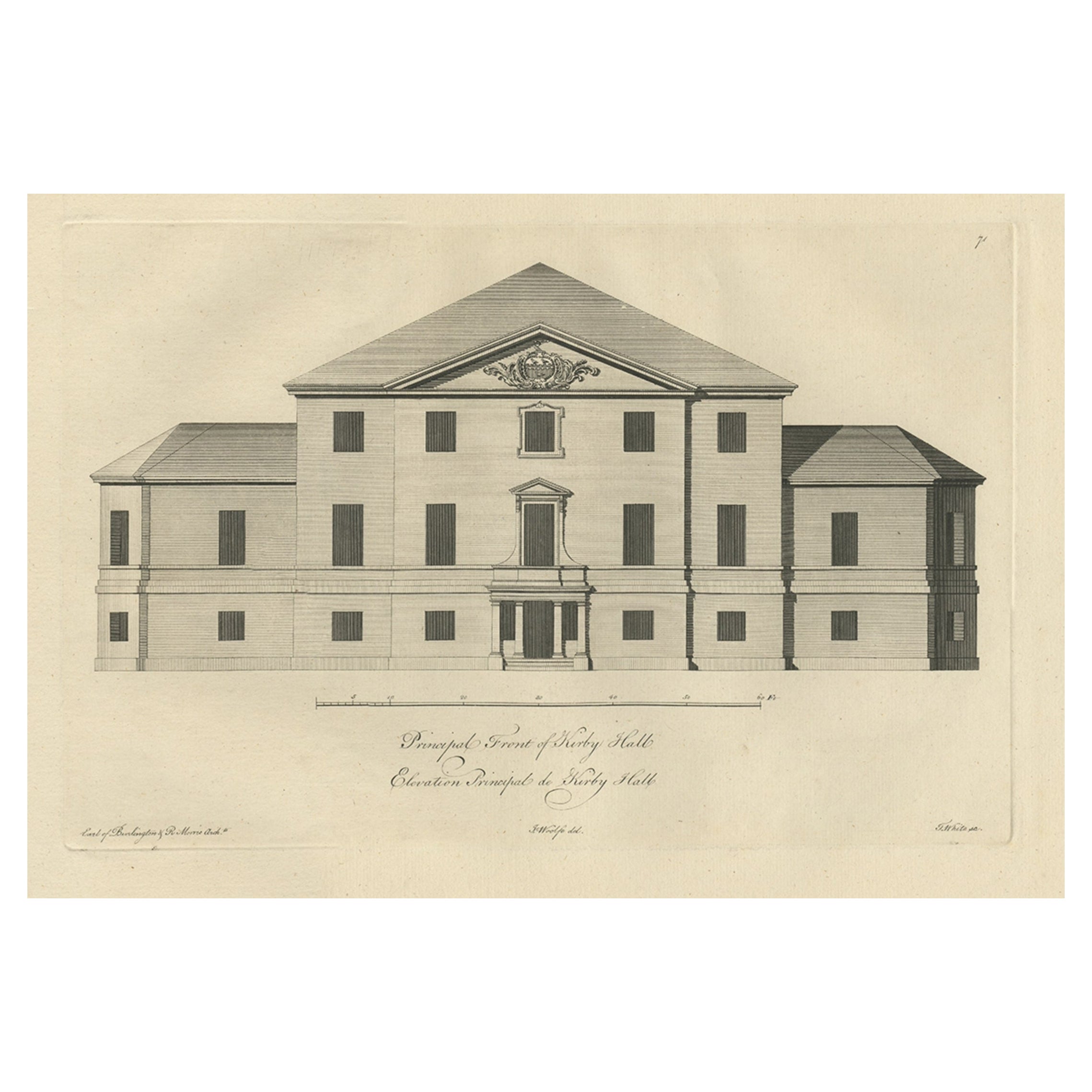
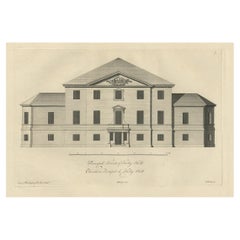
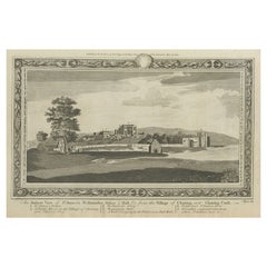
- Antique Engraving of Kirby Hall Near Gretton, Northamptonshire, England c.1770Located in Langweer, NLAntique print titled 'Principal Front of Kirby Hall'. Kirby Hall is an Elizabethan country house, located near Gretton, Northamptonshire, England. The nearest main town is Corby. One of the great Elizabethan houses of England, Kirby Hall was built for Sir Humphrey Stafford of Blatherwick, beginning in 1570. In 1575 the property was purchased by Sir Christopher Hatton of Holdenby,[1] Lord Chancellor to Queen Elizabeth I. It is a leading and early example of the Elizabethan prodigy house. Construction on the building began in 1570, based on the designs in French architectural pattern books and expanded in the Classical style over the course of the following decades. The house is now in a semi-ruined state with many parts roof-less although the Great Hall and state rooms remain intact. The gardens, with their elaborate "cutwork" design, complete with statues and urns, have been recently restored. Anne of Denmark stayed at Kirby on 9 August 1605 while King James stayed at Rockingham Castle. King James stayed for three days in August 1616. During a royal progress Esmé Stewart, 3rd Duke of Lennox died at Kirby of the "spotted ague" on 30 July 1624. The building and gardens are owned by the Earl of Winchilsea and are managed by English Heritage. Kirby Hall has been used as a filming location in many productions. These include the following; an episode (6. Protest and Communication) of Kenneth Clark...Category
Antique 18th Century Prints
MaterialsPaper
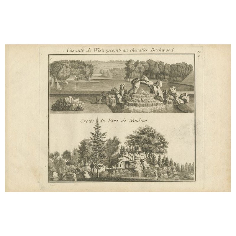
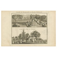
- Antique Engraving of West Wycombe Park and Windsor Park in England, ca.1785Located in Langweer, NLAntique print titled 'Cascade de Westwycob au chevalier Dashwood - Grotte du Parc de Windsor'. Copper engraving showing the waterfall of West Wycombe park and the cabe of Windsor Par...Category
Antique 18th Century Prints
MaterialsPaper
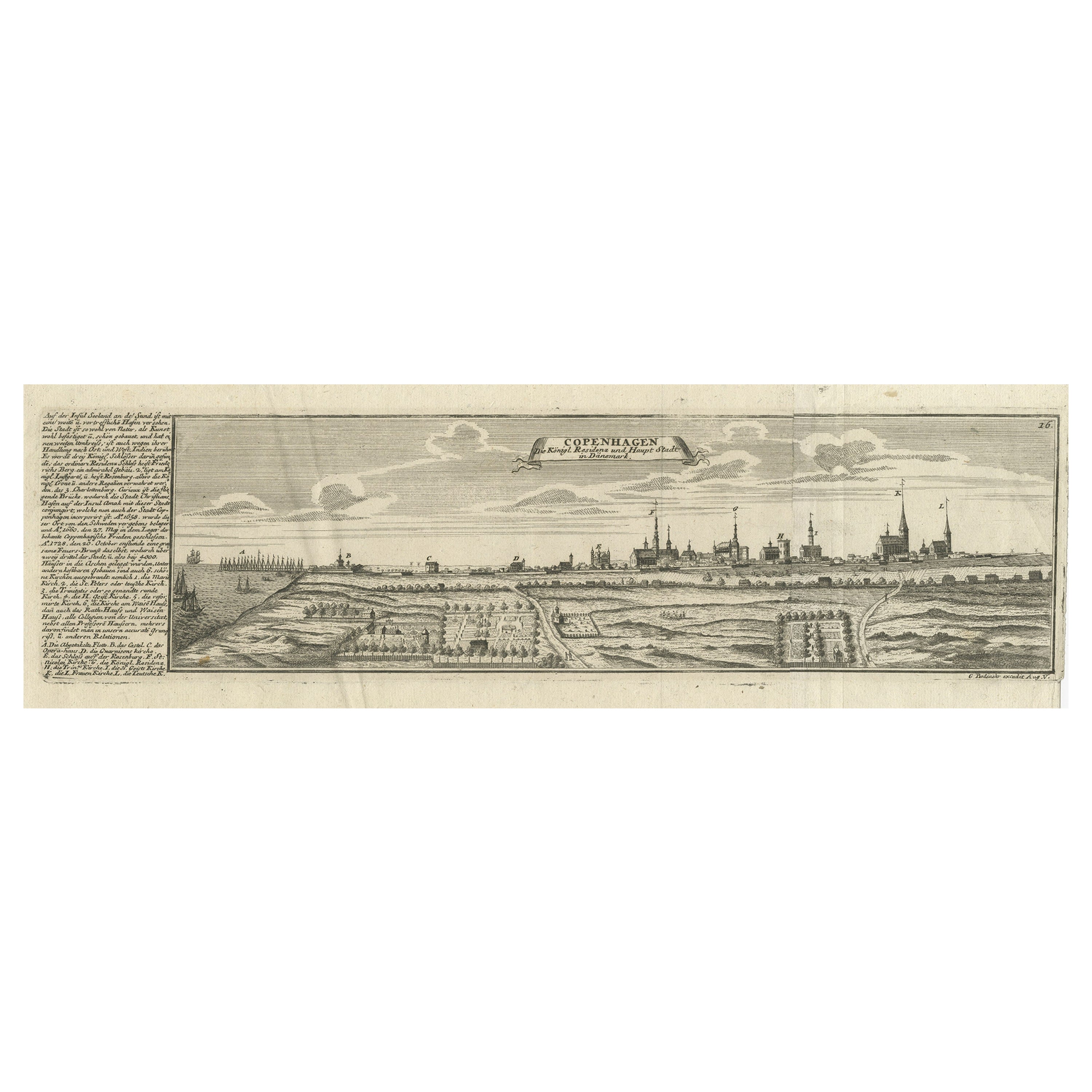
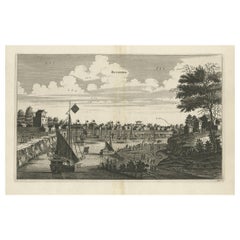
- Rare Antique Engraving of the City of Copenhagen, Denmark, ca.1720Located in Langweer, NLAntique print titled 'Copenhagen. Die Königl. Residenz und Haupt Stadt in Dänemark'. Panoramic view of the city of Copenhagen, Denmark. This print, most likely, originates from the s...Category
Antique 18th Century Prints
MaterialsPaper
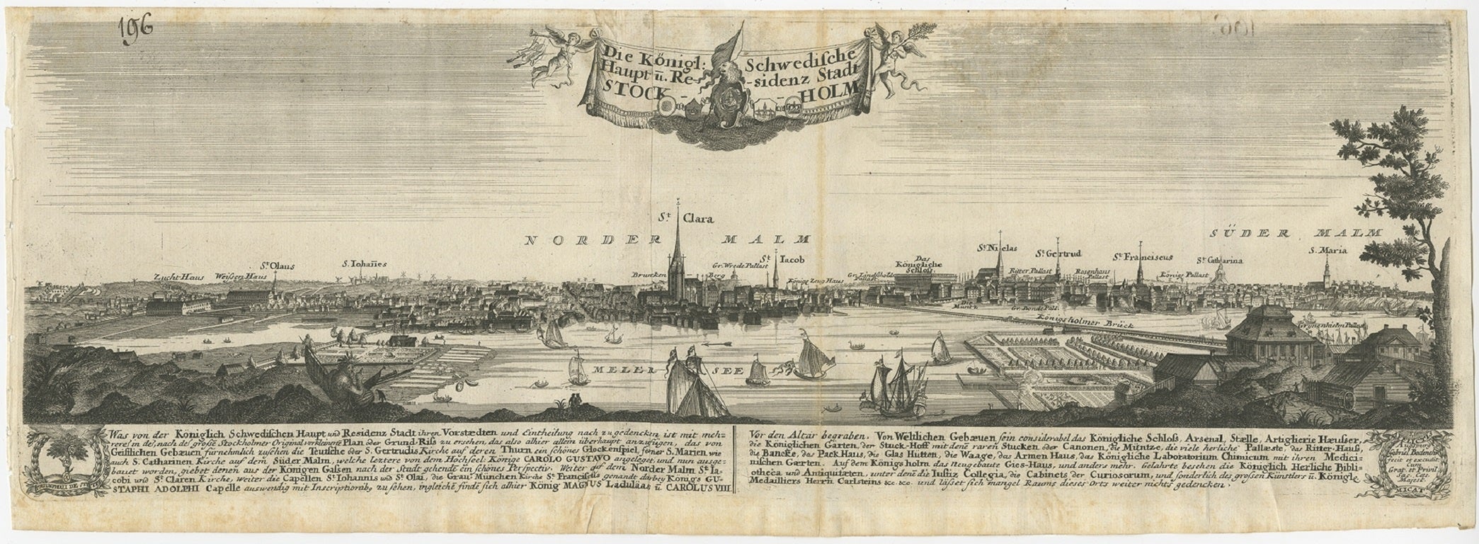
- Rare Antique Engraving of the City of Stockholm, Norway, ca.1720Located in Langweer, NLAntique print titled 'Die Königl. Schwedische Haupt und Residenz Stadt Stockholm'. Panoramic view of the city of Stockholm, Sweden. This print originates from the series 'Europe Prac...Category
Antique 18th Century Prints
MaterialsPaper
- Rare Antique Print of the Famous Westminster Abbey, London, England, C.1800Located in Langweer, NLAntique print titled 'An ancient View of St. James's (..)'. Old print of Westminster, the old Westminster Abbey in the centre, with St James's Palace on the right. Westminster Abb...Category
Antique 18th Century Prints
MaterialsPaper
You May Also Like
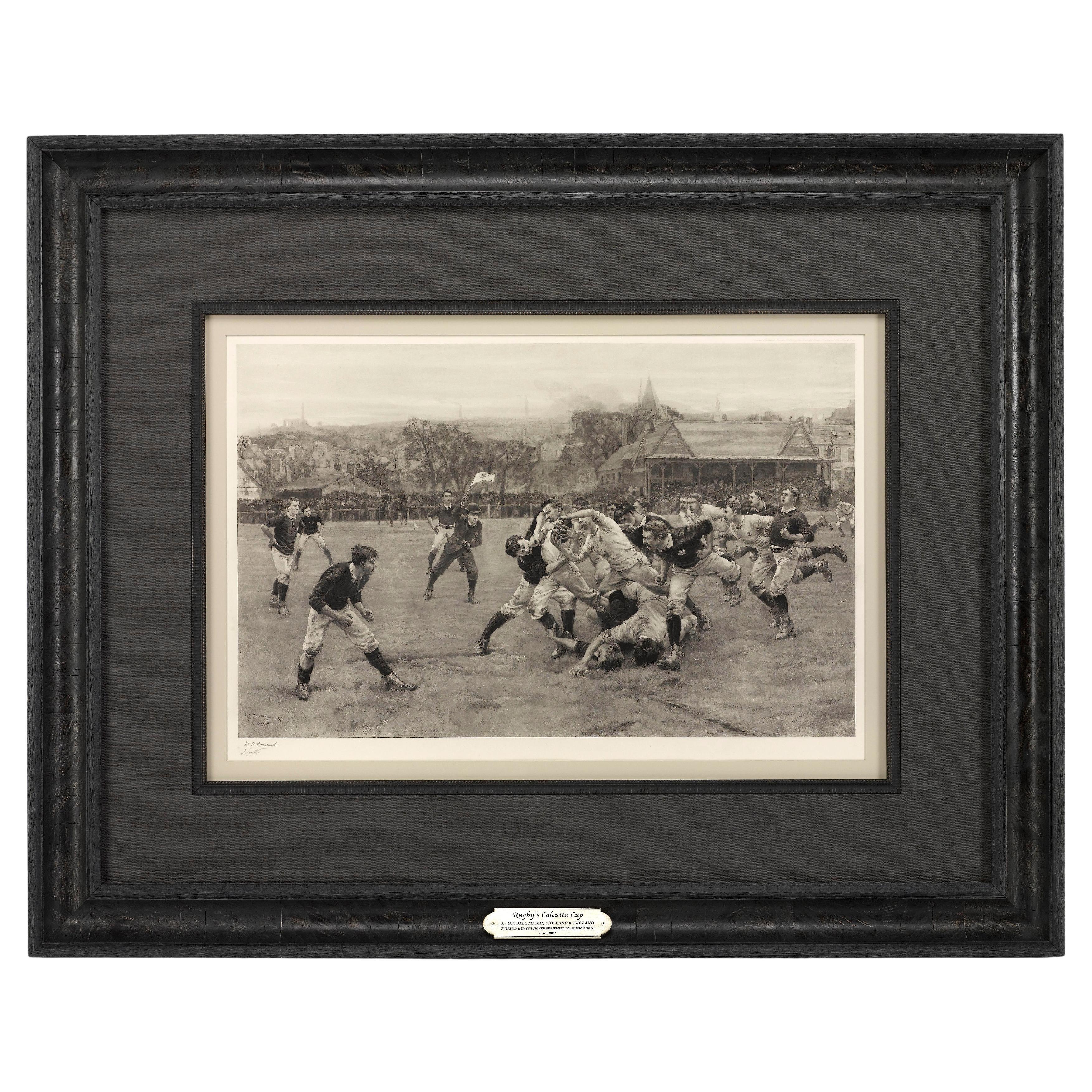
- “A Football Match, Scotland v. England” Antique Engraving, Proof Edition of 100By Overend and SmytheLocated in Colorado Springs, COThis is the 1889 William H. Overend (1851-1898) and Lionel Smythe (1839-1918) first edition, photogravure of the Calcutta Cup – a Rugby match between Scotland and England, that has been played over 100 times, the first match...Category
Antique 19th Century English Prints
MaterialsPaper
- Old Horizontal Map of EnglandBy TassoLocated in Alessandria, PiemonteST/520 - Old rare Italian map of England, dated 1826-1827 - by Girolamo Tasso, editor in Venise, for the atlas of M.r Le-Sage.Category
Antique Early 19th Century Italian Other Prints
MaterialsPaper
- Original Antique Map / City Plan of Brussels by Tallis, circa 1850Located in St Annes, LancashireGreat map of Brussels. Steel engraving. Published by London Printing & Publishing Co. (Formerly Tallis), C.1850 Free shipping.Category
Antique 1850s English Maps
MaterialsPaper
- Antique Golf Engraving, Henry Callender ESQ, Golf MezzotintLocated in Oxfordshire, GBGolf mezzotint of 'Henry Callender Esq' (Captain of the society of Golfers at Blackheath) after Lemuel Francis Abbott (1760-1803). Henry Callend...Category
Antique 1810s British Sporting Art Sports Equipment and Memorabilia
MaterialsPaper
- George Washington by Henry Sadd, Antique Engraving, circa 1844Located in Colorado Springs, COThis is an 1844 engraving of President George Washington. The print was issued by G. Stuart in Albion, New York and engraved by H. S. Sadd. This standing portrait shows President George Washington in front of neoclassical columns. In his right hand, he holds a dress sword...Category
Antique 1840s American Prints
MaterialsPaper
- 1876 "Gettysburg, The Repulse of Longstreet's Assault." EngravingLocated in Colorado Springs, COPresented here is an 1876 engraving of John B. Bachelder and James Walker’s Gettysburg. The Repulse of Longstreet’s Assault. The engraved scene depicts the decisive battle on the final day of the Battle of Gettysburg. Researched by the photographer and topographer John B. Bachelder and painted by James Walker, the original painting was created in 1870. This detailed engraving was done by H. B. Hall Jr. and published by James Drummond Ball. Otherwise called Pickett’s Charge, the battle occurred on July 3, 1863. Pickett’s corp commander, Lieutenant General James Longstreet was placed in charge of the attack despite his hesitations. Longstreet’s central role led to the title of the work, Repulse of Longstreet’s Assault. In an attempt to gain control of an important supply route, nine Confederate brigades charged across three-quarters of a mile of open ground against cannon fire to take Cemetery Ridge from the defending Union Army. Despite their overwhelming numbers, the Confederate forces were repelled with considerable casualties marking not only a decisive victory for the Union, but also the beginning of the slow defeat of Lee’s Army. The furthest the charging forces advanced before being repulsed would forever be known as the “High Water Mark of the Confederacy.” The Confederate army never recovered from the losses at Gettysburg and it effectively ended Lee’s campaign into Pennsylvania. The engraving gives the perspective from the Union rear, one that encompasses most of the battlefield, from Big Round Top on the left to the northern reaches of Cemetery Ridge on the right. The Confederate lines at Seminary Ridge are in the far distance, partially obscured by bursting shells. The image centers on the main Confederate assault, in the vicinity of what today are known as "The Copse" and "The Bloody Angle." The composition has elemen...Category
Antique 1870s American Prints
MaterialsPaper


Recently Viewed
View AllMore Ways To Browse
Pull Down World Map
Antique Clover
Antique Kitchen Wall Cabinet
Antique Kitchen Wall Cabinets
Antique Mantel Vases
Antique Walnut Beds
Art Deco Architectural Drawings
French China Cabinet
Glass Display Cabinet Pairs
King Louis Bedroom
Mid Century Modern Walnut Headboard
Midcentury Modern Walnut Headboard
Regency Jewellery
Roaring Twenties
Tall Antique French Doors
Two Panel Japanese Screen
Two Panel Screen Japan
Used Bed Frames Full Size