Items Similar to An extremely rare pair of miniature globes by Johann Baptist Homann


Video Loading
Want more images or videos?
Request additional images or videos from the seller
1 of 19
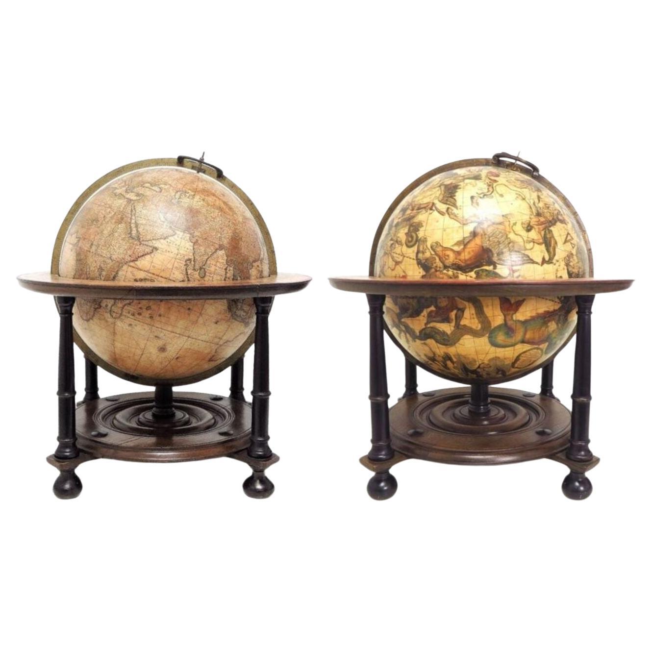
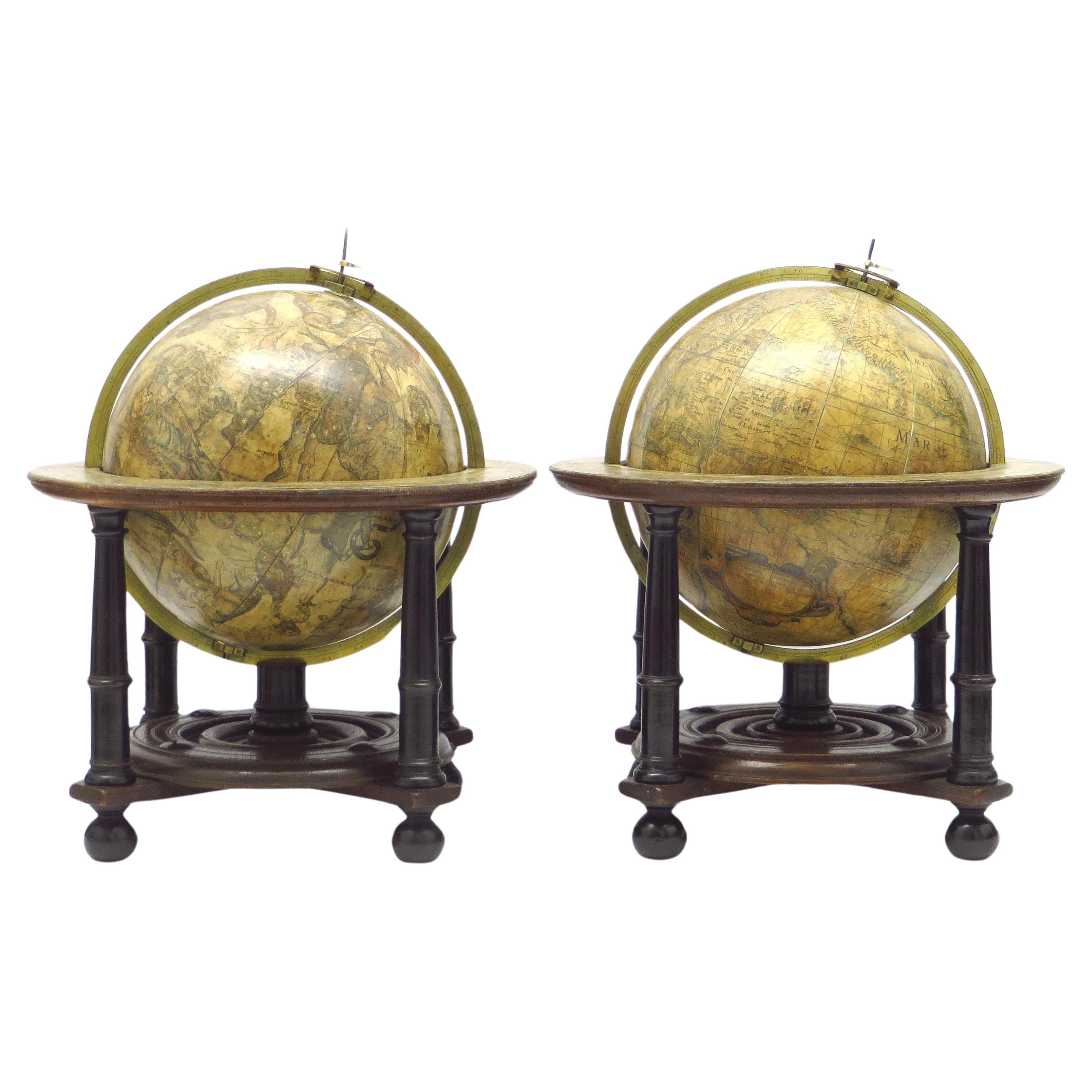
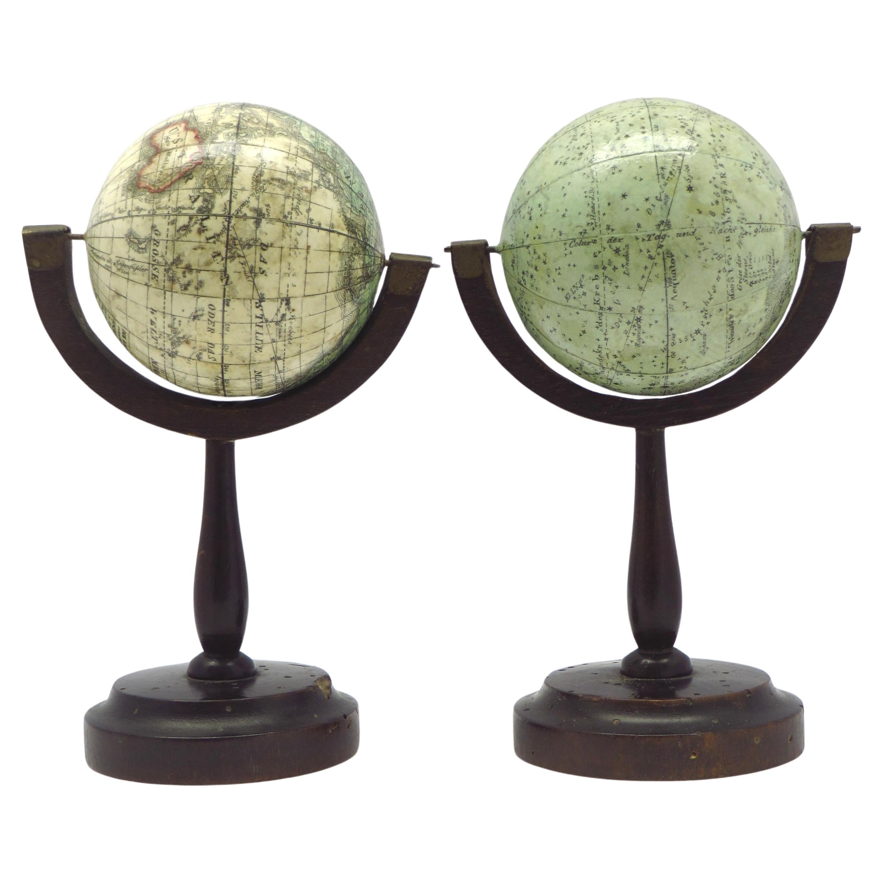
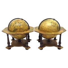
An extremely rare pair of miniature globes by Johann Baptist Homann
About the Item
J.H. Homann (Germany, 1664-1724)
Nürnberg, after 1715
Globus Terrestris [and] Globus Celestis. juxtu observationes Parisienses Regia Academia Scientiarum constructus [and] juxtu observationes Parisienses Regia Academia Scientiarum constructus. Nuremberg, [after 1715].
Original stands by Homann Heirs, [after 1730].
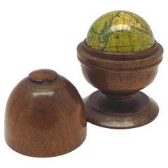
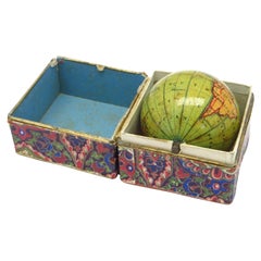
An extremely rare pair of terrestrial and celestial globes, each with 12 hand-coloured engraved paper gores, over a papier mâché and plaster sphere, each globe with papier mâché meridian ring, mounted on horizon rings with a handwritten number VIII and III on each globe. The horizon rings supported by four quadrants with text "Zu finden in Nürnberg / wohnhaft unter der Vesten / bey denen Homaenischen Erben/ dem Prediger Klöster gegenüber", both globes on a turned single wooden black stand.
Diameter 64 mm (2.5 inches), height 185 mm. RARE.
Johann Baptist Homann (1664–1724), a German geographer and cartographer. He founded a publishing business in Nürnberg in 1702, and published his first atlas in 1707, becoming a member of the Academy of Sciences in Berlin in the same year. Homann was appointed Imperial Geographer to Charles VI in 1715 and became the most important map and atlas producer in Germany. His firm was continued by his son Johann Christoph after his death and as Johann Christoph died the company continued under the name of Homann Heirs until 1848.
Meridian rings with slight wear.
The globes have been checked by the Homann specialist which is Herr. Dr. M. Heinz, Staatsbibliothek zu Berlin.
- Creator:Johann Baptist Homann (Maker)
- Dimensions:Height: 7 in (17.78 cm)Diameter: 2.5 in (6.35 cm)
- Style:Dutch Colonial (Of the Period)
- Materials and Techniques:
- Place of Origin:
- Period:1710-1719
- Date of Manufacture:1715
- Condition:Complete contemporary.
- Seller Location:ZWIJNDRECHT, NL
- Reference Number:1stDibs: LU9419237363122

Johann Baptist Homann
Johann Baptist Homann (1663-1724) was a mapmaker who founded a respected and prolific publishing company, which continued long after his death as Homann Heirs. Homann lived his entire life in Bavaria, particularly in Nuremberg. Initially, Johann trained to become a priest before converting to Protestantism and working as a notary. In 1702, Johann founded a publishing house that specialized in engravings. The firm flourished, becoming the leading map publisher in Germany and an important entity in the European map market. In 1715, Johann was named Imperial Geographer to the Holy Roman Empire by Charles VI and made a member of the Prussian Academy of Sciences. Most importantly for his business, his reputation and contacts gained him imperial printing privileges which protected his publications and recommended him to customers.
About the Seller
No Reviews Yet
Vetted Seller
These experienced sellers undergo a comprehensive evaluation by our team of in-house experts.
1stDibs seller since 2023
- ShippingRetrieving quote...Ships From: ZWIJNDRECHT, Netherlands
- Return PolicyA return for this item may be initiated within 14 days of delivery.
More From This SellerView All
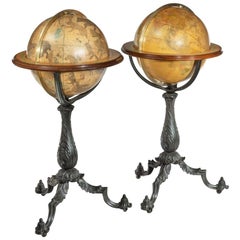
- A pair of extremely rare Valk table globesBy Gerard and Leonard ValkLocated in ZWIJNDRECHT, NLTitle on the globes: VALK, Gerard and Leonard. [Terrestrial globe:] Cosmotheore, caelesti nostro globo, par, et plane novus, hic terrestris ut existeret, certo scias, errore veterum ...Category
Antique 18th Century Dutch Dutch Colonial Globes
MaterialsOther
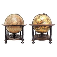
- An exceptional pair of BLAEU table globesBy Willem BlaeuLocated in ZWIJNDRECHT, NLA very rare set of globes, 9 inch / 23cm, with an overall height of 38 cm, Amsterdam, dated 1602, but published after 1621. In their original stands with circular wooden horizon rings, covered with printed paper, supported by four legs and brass meridian rings supported by a single column. The terrestrial and celestial globe are made up of a set of 12 engraved gores, heightened in gold and Arctic ice caps, printed on paper and mounted on a plaster sphere of papier maché. Each sphere is mounted in a graduated brass meridian ring with the production number stamped at the back of the ring. Both globes are mounted on four-legged ebonized oak Dutch stands, which support the horizon ring. The legs are connected by two crossbeams which support a circular base plate with central support for the meridian ring. The horizon rings are covered with printed paper. With usual defects: paper equinoctial tables present gaps that are filled and restored; small splits along gores; several partially deleted entries; on the globe, the date 1602 and the text of the cartouche in America, are illegible ; small scattered spots but in general in good condition for such an early globe pair of which presently only 19 pair are recorded. These 9-inch globes are among the rarest since very few copies of them are known to exist, in comparison with the smaller or larger globes of Blaeu (4, 6, 13.5, and 26 inches). Blaeu's terrestrial globes were highly valued and were much in demand, because of the care with which they had been prepared, because of the efforts to give the latest information on discoveries, and because of the loxodromic lines that made them of special value to navigators. His celestial globes were appreciated for the fact that he had been the pupil of Tycho Brahe, who was himself known to be the greatest astronomer of his time. Willem Janszoon Blaeu (1571–1638), originally trained in astronomy, he quickly became a leading maker of maps, atlases and instruments. Blaeu’s globes were luxury items for wealthy and intellectual merchants and nobility who benefited from Blaeu’s access through the Dutch East India Company to the latest navigational discoveries and geographical information. Willem Jansz Blaeu collected information that Dutch mariners gathered from around world and brought back to Amsterdam. Crews were instructed to record information about the lands they visited and the skies they saw. Blaeu incorporated these observations in maps and globes. Through his web of contacts and thanks to assiduous research, he was also able to obtain the most recent information about the latest discoveries in the western hemisphere and the South Pacific, where Dutch explorers were particularly active at the time. Since the globe was published after 1618, Blaeu was able to include the discoveries made by Henry Hudson in his attempt to find a passage to the East Indies. He also included recent Pacific discoveries of the celebrated voyages of Willem Cornelis Schouten and Jacob Le Maire, who both traversed the South Pacific and the Atlantic. The findings of Schouten and Le Maire in the Tierra del Fuego region are also incorporated. The Strait of Le Maire is drawn and the hypothetical southern continent is labelled “Terra Australis Incognita Magalanica”. Olivier van Noort’s track is drawn and labelled. His route is indicated with a broken line and the words: “Navigationis Olivierij ductus” (several times). There are various decorative features, such as animals on the different continents, many ships on the high seas and allegorical and mythical figures around the cartouches. The nine-inch globe is not just a smaller version of the one published in 1599. Drawings of animals and people do often correspond to those on the earlier globe, but Blaeu made several significant changes. - The west coast of North America is drawn differently and the river system of Brazil is altered. - The hypothetical southern continent is labelled: Terra Australis Incognita Magallanica. - There are nine ocean names in handsome curling letters: Mare Congelatum, Mare Atlanticum, Oceanus Aethiopicus, Mare Arabicum et Indicum, Mare di India, Oceanus Chinensis, Mar del Zur, Mare Pacificum, Mar del Nort. - Willem Blaeu...Category
Antique 17th Century European Dutch Colonial Globes
MaterialsOther

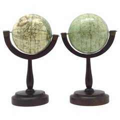
- A fine pair of miniature globes on standsBy Karl MullerLocated in ZWIJNDRECHT, NLA rare pair of miniature terrestrial and celestial globes. by K. Müller, 1822 Karlsruhe, Germany Diameter globes: 7 cm. Total high: 14,5 cm. Each with 12 hand-coloured engraved p...Category
Antique Early 19th Century German International Style Globes
MaterialsHardwood, Paper
- A decorative pair of rare table globes in a fine condition.By Johann Gabriel DoppelmayrLocated in ZWIJNDRECHT, NLThese pair of globes, dated 1730, are original and in fine condition. Title: Globus terrestris novus Loca Terrae insigniora sec. praestant Astron. et Geogr. observationes sistens op...Category
Antique Early 18th Century German Baroque Globes
MaterialsOther
- Miniature globe in aturned and stained beechBy Newton and SonLocated in ZWIJNDRECHT, NLNewton & Son pocket globe London, 1838 Miniature terrestrial globe with a diameter of 2 inches / 5 cm. In a turned and stained beech two-section case, 3,95 inches / 10 cm. high.Category
Antique 19th Century British Late Victorian Globes
MaterialsFruitwood, Paper
- Miniature pocket globe in colourful card boxBy Michael ManningLocated in ZWIJNDRECHT, NLMiniature terrestrial pocket globe. Model of the earth. London, 1857 by J. Manning diameter of 1,75 inches / 4,5 cm. This lovely miniature terrestrial globe consists of twelve copp...Category
Antique 19th Century British Early Victorian Globes
MaterialsHardwood, Paper
You May Also Like
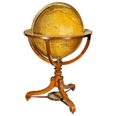
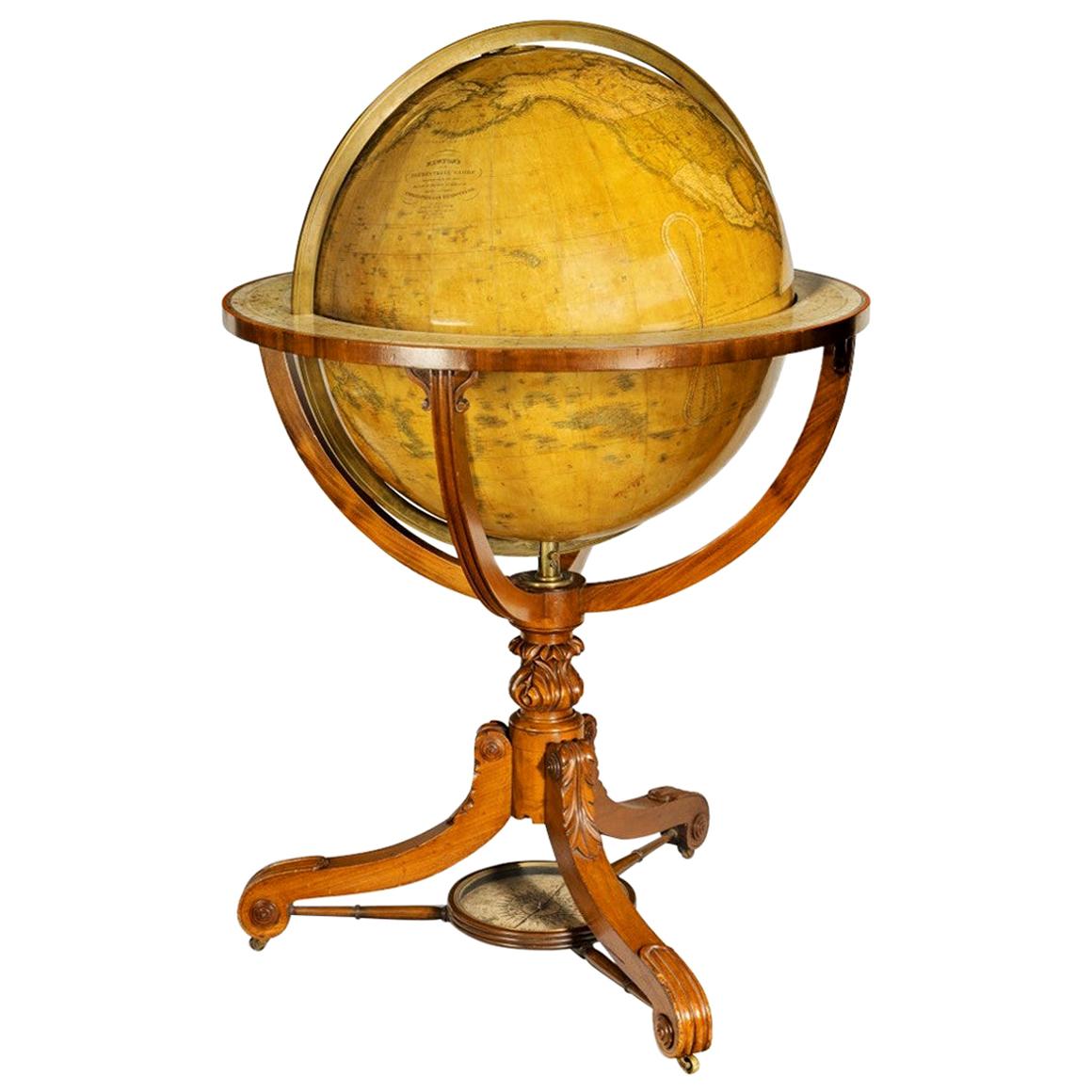
- Large and Extremely Rare Terrestrial Globe by NewtonBy Newton Globes - Planer & NewtonLocated in Lymington, HampshireA large and extremely rare 24-inch terrestrial globe by Newton Our most magnificent and rare globes were a pair of 24-inch Newton globes. These too were updated in 1852 (terre...Category
Antique Mid-19th Century English Globes
MaterialsMahogany
- Extremely Rare Cantilevered Style Teak & Brass World GlobeLocated in East Hampton, NYThis Arts & Crafts style floor height world globe made by Replogle Company in the 1960's, is on a super original cantilever base with brass rod and teak frame. Very clean 16 inch dia...Category
Vintage 1960s American Arts and Crafts Globes
MaterialsBrass
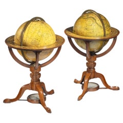
- Rare Pair of Table Globes by Cary, Each Dated 1816By John & William CaryLocated in Lymington, HampshireA rare pair of 9 inch table globes by Cary, each dated 1816. These globes are by John and William Cary and show the geographical and political borders drawn up following the Congress of Vienna. Each one is surmounted by a brass hour circle, within a calibrated full brass meridian, and a horizon band with an engraved paper calendar...Category
Antique 1810s English Globes
MaterialsBrass
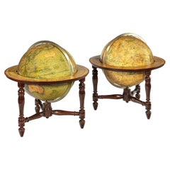
- Pair of Table Globes by J & W Newton, Dated 1820By John & William NewtonLocated in Lymington, HampshireA pair of 12 inch table globes by J & W Newton, dated 1820, each with 12 hand coloured gores, graduated meridian rings, set within ebonised stands with t...Category
Antique 1820s English Regency Globes
MaterialsWood
- Pair of Floor Standing Globes by Gilman JoslinBy Gilman JoslinLocated in Lymington, HampshireA pair of 16-inch floor standing globes by Gilman Joslin, each set into a cast-iron tripod base with an acanthus-leaf baluster support on three b...Category
Antique 19th Century American Maps
MaterialsIron
- Antique 19th Century Miniature French Edition Globe by C. Abel-KlingerBy C. Abel-KlingerLocated in Philadelphia, PAA fine antique French Edition miniature globe. By C. Abel-Klinger. On a turned wooden stand with an uncalibrated brass half meridian. The globe is marked with an integral l...Category
Antique 19th Century German Neoclassical Maps
MaterialsPaper