Items Similar to Original Antique Map of Italy. C.1780


Want more images or videos?
Request additional images or videos from the seller
1 of 5
Original Antique Map of Italy. C.1780
About the Item
Great map of Italy
Copper-plate engraving
Published C.1780
Unframed.
- Dimensions:Height: 8.25 in (20.96 cm)Width: 12 in (30.48 cm)Depth: 0.07 in (1.78 mm)
- Style:Georgian (Of the Period)
- Materials and Techniques:Paper,Other
- Place of Origin:
- Period:
- Date of Manufacture:1780
- Condition:Wear consistent with age and use.
- Seller Location:St Annes, GB
- Reference Number:1stDibs: LU1836335044822
About the Seller
4.9
Platinum Seller
These expertly vetted sellers are 1stDibs' most experienced sellers and are rated highest by our customers.
1stDibs seller since 2016
2,663 sales on 1stDibs
Typical response time: 1 hour
Associations
International Confederation of Art and Antique Dealers' Associations
- ShippingRetrieving quote...Ships From: St Annes, United Kingdom
- Return PolicyA return for this item may be initiated within 3 days of delivery.
Auctions on 1stDibs
Our timed auctions are an opportunity to bid on extraordinary design. We do not charge a Buyer's Premium and shipping is facilitated by 1stDibs and/or the seller. Plus, all auction purchases are covered by our comprehensive Buyer Protection. Learn More
More From This SellerView All
- Original Antique Map of Italy. Arrowsmith. 1820Located in St Annes, LancashireGreat map of Italy Drawn under the direction of Arrowsmith Copper-plate engraving Published by Longman, Hurst, Rees, Orme and Brown, 1820 Unframed.Category
Antique 1820s English Maps
MaterialsPaper
- Original Antique Map of Ireland- Kerry. C.1840Located in St Annes, LancashireGreat map of Kerry Steel engraving Drawn under the direction of A.Adlard Published by How and Parsons, C.1840 Unframed.Category
Antique 1840s English Maps
MaterialsPaper
- Original Antique Map of China, Arrowsmith, 1820Located in St Annes, LancashireGreat map of China Drawn under the direction of Arrowsmith Copper-plate engraving Published by Longman, Hurst, Rees, Orme and Brown, 1820 Unfr...Category
Antique 1820s English Maps
MaterialsPaper
- Original Antique Map of Canada, Arrowsmith, 1820Located in St Annes, LancashireGreat map of Canada. Drawn under the direction of Arrowsmith. Copper-plate engraving. Published by Longman, Hurst, Rees, Orme and Brown, 1820 ...Category
Antique 1820s English Maps
MaterialsPaper
- Original Antique Map of France, Arrowsmith, 1820Located in St Annes, LancashireGreat map of France Drawn under the direction of Arrowsmith. Copper-plate engraving. Published by Longman, Hurst, Rees, Orme and Brown, 1820 Unframed.Category
Antique 1820s English Maps
MaterialsPaper
- Original Antique Map of Europe, Arrowsmith, 1820Located in St Annes, LancashireGreat map of Europe Drawn under the direction of Arrowsmith. Copper-plate engraving. Published by Longman, Hurst, Rees, Orme and Brown, 1820 ...Category
Antique 1820s English Maps
MaterialsPaper


You May Also Like
- Antique Map of Italy by R. Bonne, circa 1780Located in Langweer, NLBeautiful map of Italy, Corsica, Sardinia and Sicily. Highly detailed, showing towns, rivers, some topographical features and political boundaries. Published by R. Bonne, circa 1780.Category
Antique Late 18th Century Maps
MaterialsPaper
- Antique Map of Sumatra, Indonesia 'c.1780'Located in Langweer, NLAntique map titled 'Neue Karte von der Insel Sumatra'. Extremely rare map of Sumatra, Indonesia. Published circa 1780.Category
Antique Late 18th Century Maps
MaterialsPaper
- Antique Map of Europe by R. Bonne, 1780Located in Langweer, NLA fine example of Rigobert Bonne and Guilleme Raynal’s 1780 map of Europe. Drawn by R. Bonne for G. Raynal’s Atlas de Toutes les Parties Connues du Globe Terrestre, Dressé pour l'His...Category
Antique Late 18th Century Maps
MaterialsPaper
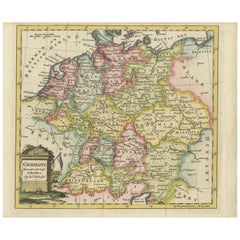
- Antique Map of Germany by T. Kitchin, circa 1780Located in Langweer, NLAttractive map with decorative cartouche from "A New Geographical, Historical, and Commercial Grammar and Present State of the Several Kingdoms of the World by William Guthrie, print...Category
Antique Late 18th Century Maps
MaterialsPaper
- Antique Map of West Africa by R. Bonne, 1780Located in Langweer, NLAntique map titled 'Partie Occidentale De L'Ancien Continent Depuis Lisbonne Jusqua La Riviere De Sierra Leona Avec L'Isle de Madere, les Isles Canaries et celles Du Cap Verd'. Parts...Category
Antique Late 18th Century Maps
MaterialsPaper
- Antique Map of the Arabian Peninsula by Bonne 'c.1780'Located in Langweer, NLAntique map titled 'Carte de l'Arabie, du Golfe Persique, et de la Mer Rouge (..)'. Original antique map of the Arabian Peninsula, including the horn...Category
Antique Late 18th Century Maps
MaterialsPaper


Recently Viewed
View AllMore Ways To Browse
Antique Saudi
Arabian Peninsula
Colombia Map
Framed Map Asia
Map Of Bengal
Map Of Syria
United States Civil War Map
Afghanistan Antique Map
Antique Furniture Santa Cruz
Antique Mississippi Map
Hindeloopen Furniture
Madagascar Antique Map
Map Of Prussia
Normandy Map
Prussia Map
Antique Map Of Florida
Antique Map Of Mississippi
Antique Maps Of Florida