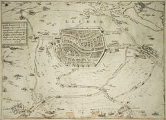
Items Similar to Nuremberg, Map from "Civitates Orbis Terrarum" - by F. Hogenberg - 1575
Want more images or videos?
Request additional images or videos from the seller
1 of 2
Franz HogenbergNuremberg, Map from "Civitates Orbis Terrarum" - by F. Hogenberg - 15751575
1575
About the Item
Braun G., Hogenberg F., Nurnberg or Nuremberg, from the collection Civitates Orbis Terrarum, Cologne, T. Graminaeus, 1572-1617.
Very fine B/W aquatint showing a view of Nuremberg. Strongly influenced by Hartmann Schedel's Nuremberg Chronicles, Braun and Hogenberg represented a strongly-idealized city as an unconquered fortress and a Great Imperial Castle. The gaps among the various parts of the city are greatly reduced, for the sake of a "flat" vision, evidently judged more harmonious. Good conditions, with a usual medial fold and minor stains on the top left and right corners.
The “Civitates Orbis Terrarum” (Atlas of Cities of the World) was the second oldest printed atlas in the history of world cartography and the first atlas totally dedicated to topographical views. The first volume of this collection was published at Cologne in 1572; the others following in 1575, 1581, 1588 and 1598. The sixth and final volume appeared in 1617, just before the extensive devastation wreaked by the Thirty Years’War.
“The most original and magnificent of all city-atlases, which drew on the work of accomplished topographical artists; and…reproduced it in pictorial compositions of great charm and individuality”. R.A.Skelton
This artwork is shipped from Italy. Under existing legislation, any artwork in Italy created over 70 years ago by an artist who has died requires a licence for export regardless of the work’s market price. The shipping may require additional handling days to require the licence according to the final destination of the artwork.
- Creator:Franz Hogenberg (1540 - 1590, Flemish)
- Creation Year:1575
- Dimensions:Height: 5.91 in (15 cm)Width: 21.26 in (54 cm)Depth: 0.04 in (1 mm)
- Medium:
- Period:
- Condition:Insurance may be requested by customers as additional service, contact us for more information.
- Gallery Location:Roma, IT
- Reference Number:

Franz Hogenberg
Braun and Hogenberg's 'The Civitates Orbis Terrarum' was the second atlas of maps ever published and the first atlas of cities and towns of the world. It is one of the most important books published in the 16th century. Most of the maps in the atlas were engraved by Franz Hogenberg and the text, with its descriptions of the history and additional factual information of the cities, was written by a team of writers and edited by Georg Braun. The work contained 546 bird-eye views and map views of cities and towns from all over the world. It gave graphic representation of the main features of the illustrated cities and towns, including the buildings and streets. Although the ordinary buildings are stylized, the principal buildings are reproduced from actual drawings created on location. The principal landmarks and streets can still be recognized today. In addition, the maps often include the heraldic arms of the city, the nature of the surrounding countryside, the important rivers, streams and harbors, even depicting stone bridges, wooden pontoons, flat-bottomed ferries, ships and working boats, wharves and jetties, as well as land-based activities, including horsemen, pedestrians, wagons, coaches, and palanquins. Small vignettes are often included which illustrate the trade, occupations and habits of the local inhabitants, such as agriculture, paper-making and textiles, as well as local forms of punishment, such as gibbets, wheels, floggings etc. Large figures dressed in their local costume are often presented out of proportion in the foreground. The aim of the authors was to give as much information as possible in a pleasing visual form. They succeeded in creating maps that were both informative and decorative works of art. The atlas is a wonderful glimpse of life in medieval Europe. Georg Braun (1541-1622) was German Catholic cleric who was born and who died in Cologne, Germany. He was the principal editor of 'The Civitates Orbis Terrarum', acquiring the tables, hiring the artists, and composing the texts. Abraham Ortelius, whose Theatrum Orbis Terrarum of 1570 was the first atlas of maps ever published, assisted Braun in his compilation of the details and maps for the atlas. The Civitates was intended as a companion for the Ortellius' Theatrum, as suggested by the similarity in the titles. Braun was the only survivor of the original team to live to see the publication of last volume (VI) in 1617. Franz Hogenberg (1535-1590) was a Flemish and German painter, engraver, and mapmaker. He was born in Mechelen (also known as Malines) in Flanders, the son of an engraver. After being expelled from Antwerp by the Duke of Alva, he moved to London and then eventually to Cologne, Germany, where he met Georg Braun and Abraham Ortellius. He engraved most of the plates for Ortelius's Theatrum and the majority of those in the Civitates. Many believe that he was responsible for originating the Civitates project.
About the Seller
4.9
Platinum Seller
These expertly vetted sellers are 1stDibs' most experienced sellers and are rated highest by our customers.
1stDibs seller since 2017
6,839 sales on 1stDibs
Typical response time: 3 hours
- ShippingRetrieving quote...Ships From: Rome, Italy
- Return PolicyA return for this item may be initiated within 14 days of delivery.
More From This SellerView All
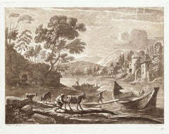
- Landscape - Etching and Aquatint on Paper by L. Caracciolo After C. LorrainLocated in Roma, ITLandscape is an original etching and aquatint on paper realized by Claudio di Lorena. Signed on the plate, on the lower left. plate no. 183, lower on the right, edition "L. Caraccio...Category
1810s Figurative Prints
MaterialsEtching, Aquatint
- Landscape from Liber Veritatis - B/W Etching after Claude Lorrain - 1815By Ludovico CaraccioloLocated in Roma, ITImage dimensions: 19 x 25 cm. Landscape is an original etching on paper realized by Claudio di Lorena. Signed on the plate, on the lower left. plate no. 23, written lower on the ri...Category
1810s Old Masters Figurative Prints
MaterialsEtching, Aquatint
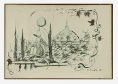
- The Domes - Lithograph by Felice Ludovisi - 1968Located in Roma, ITThe Domes is a modern artwork realized by Felice Ludovisi in 1968. China and penmarker drawing on paper. Hand signed and dated on the lower margin. ...Category
1980s Contemporary Figurative Prints
MaterialsPaper, Aquatint
- Leyden, Map from "Civitates Orbis Terrarum" - by F. Hogenberg - 1575By Franz HogenbergLocated in Roma, ITBraun G., Hogenberg F., Leyden, from the collection Civitates Orbis Terrarum, Cologne, T. Graminaeus, 1572-1617. The “Civitates Orbis Terrarum” (Atlas of Cities of the World) was th...Category
16th Century Figurative Prints
MaterialsAquatint, Etching
- Luneburg, Map from "Civitates Orbis Terrarum" - by F.Hogenberg - 1575By Franz HogenbergLocated in Roma, IT"Luneburg", from the collection "Civitates Orbis Terrarum", Cologne, T. Graminaeus, 1575. The “Civitates Orbis Terrarum” (Atlas of Cities of the World) was the second oldest print...Category
16th Century Figurative Prints
MaterialsAquatint, Etching
- Cascale, Map from "Civitates Orbis Terrarum" - by F. Hogenberg - 1575By Franz HogenbergLocated in Roma, ITBraun G., Hogenberg F., Cascale, from the collection Civitates Orbis Terrarum, Cologne, T. Graminaeus, 1572-1617. Good conditions expect tue usual central fold. The “Civitates Orbis...Category
16th Century Figurative Prints
MaterialsAquatint, Etching
You May Also Like
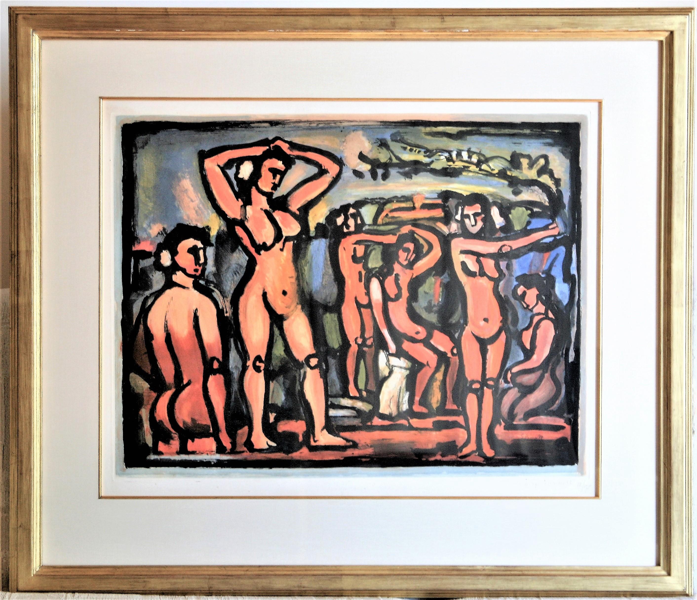
- Automne (Autumn)By Georges RouaultLocated in Storrs, CTAutomne (Autumn). 1938. Aquatint print in colors. Chapon/Rouault 288C. 19 1/2 x 25 1/2 ( sheet 22 5/8 x 30 3/4). Edition 175, #58. Published by Vollard. A rich impression with brigh...Category
Mid-20th Century Expressionist Figurative Prints
MaterialsAquatint, Color
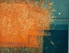
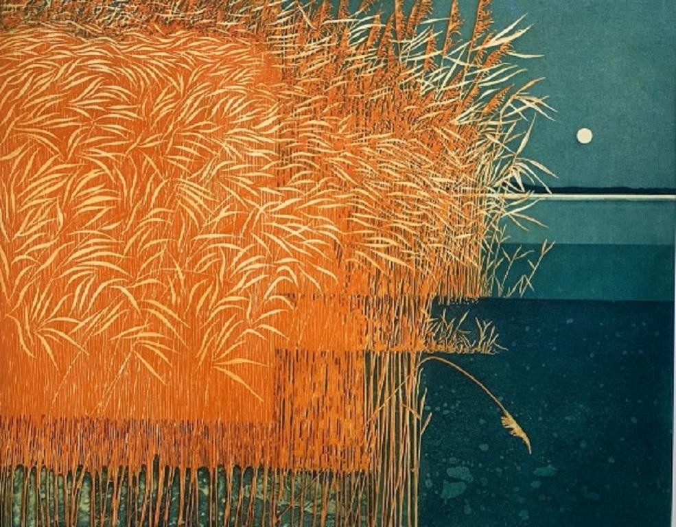
- Phil Greenwood, Reeds, Limited edition landscape printBy Phil GreenwoodLocated in Deddington, GBReeds by Phil Greenwood [2021] limited_edition Aquatint Etching Edition number 150 Image size: H:48 cm x W:59.5 cm Complete Size of Unframed Work: H...Category
21st Century and Contemporary Contemporary Landscape Prints
MaterialsAquatint
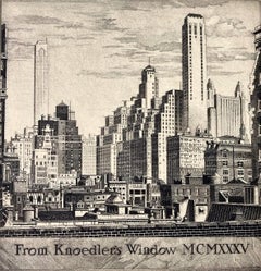
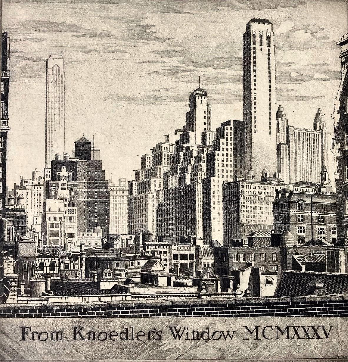
- From Knoedler's Window MCMXXXVBy John Taylor ArmsLocated in Storrs, CTFrom Knoedler's Window MCMXXV. 1935. Etching and Aquatint. Fletcher catalog 293 stateiv/v. Image: 5 1/16 x 4 15/16 (sheet 12/7/8 x 9 1/8). Edition 271 in this state (total edition 3...Category
1920s American Modern Landscape Prints
MaterialsAquatint, Etching
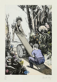
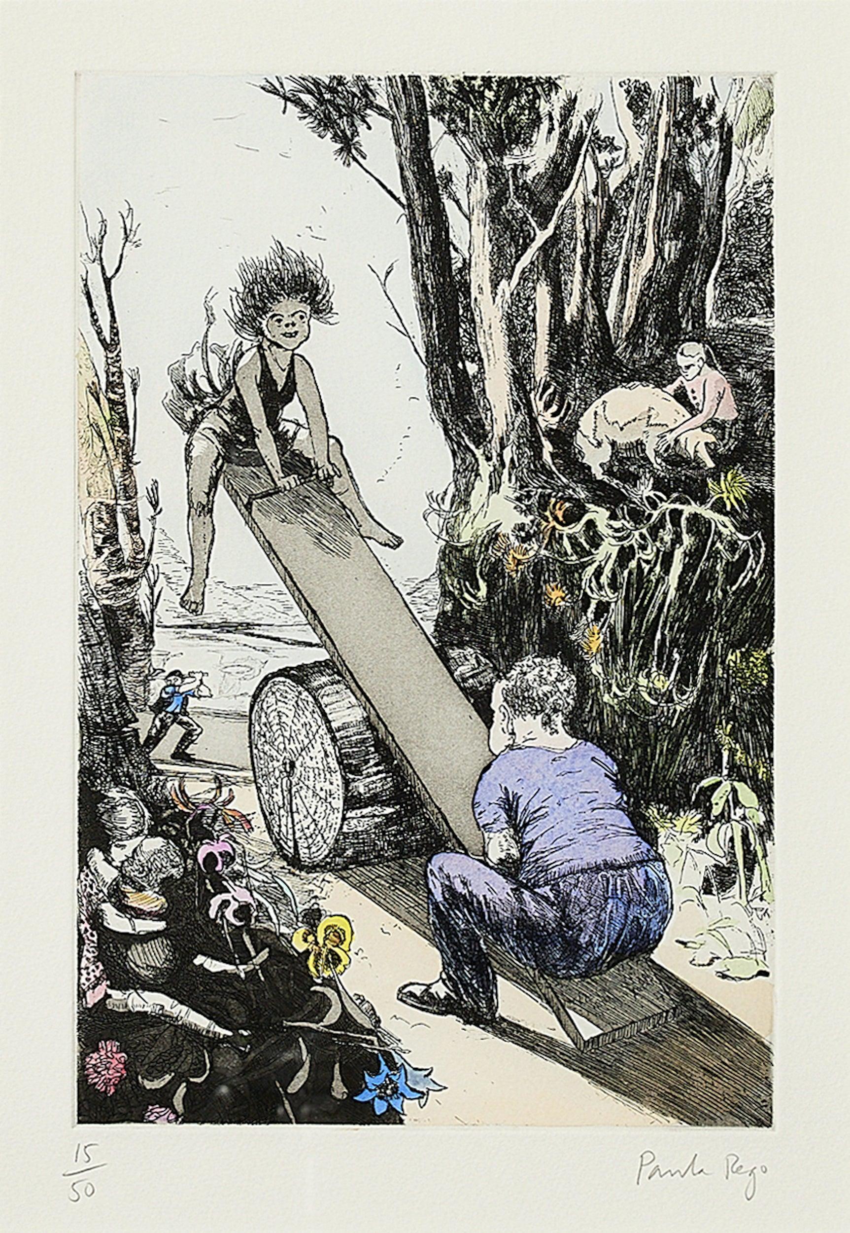
- See-saw, Margery Daw -- Print, Etching, Nursery Rhymes by Paula RegoBy Paula RegoLocated in London, GBSee-saw, Margery Daw, 1994 Paula Rego Etching with aquatint and hand-colouring, on velin Arches Signed and numbered from the edition of 50 From Nursery Rhymes Printed by Culford P...Category
1980s Contemporary Figurative Prints
MaterialsEtching, Aquatint
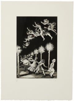
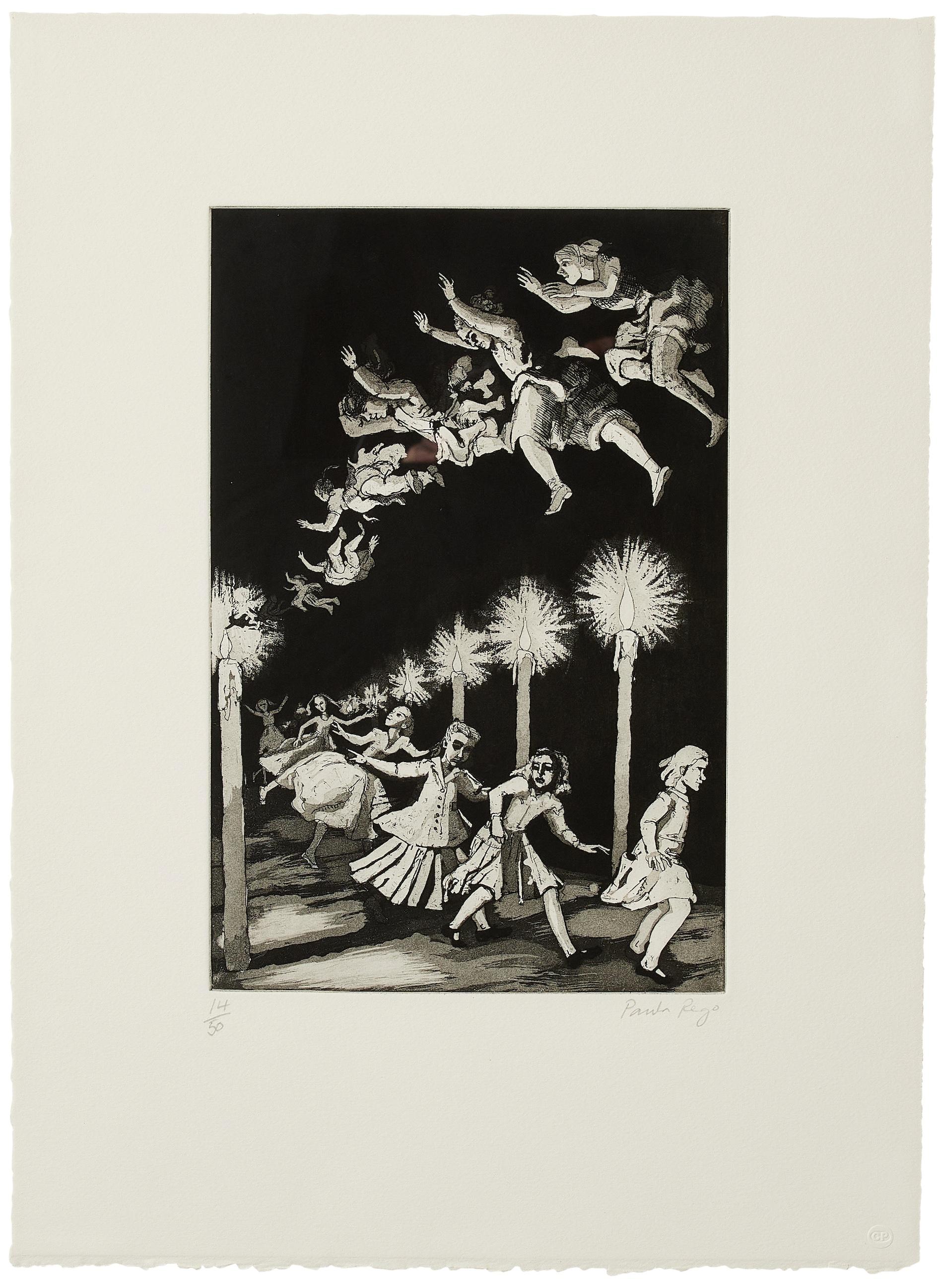
- How Many Miles to Babylon -- Print, Etching, Nursery Rhymes by Paula RegoBy Paula RegoLocated in London, GBHow Many Miles to Babylon, 1989 Paula Rego Etching with aquatint, on velin Arches Signed and inscribed ‘A/P’, apart from the edition of 50 From Nursery Rhym...Category
1980s Contemporary Figurative Prints
MaterialsEtching, Aquatint
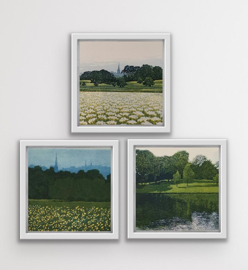
- Heath Land, Heath Pond and Heath View DiptychBy Phil GreenwoodLocated in Deddington, GBHeath Land, Heath Pond and Heath View Diptych Overall image size cm : H28 x W32 Overall sheet size cm : H52 x W52 Phil Greenwood Heath Land Limited Ed...Category
2010s Contemporary Figurative Prints
MaterialsPaper, Etching, Aquatint